| Survey
and Cartography Section of the National Speleological Society |
| Survey
and Cartography Section of the National Speleological Society |
| Home | Contacts |
Meetings |
Compass
& Tape |
Cartographic Salon |
Resources |
 |
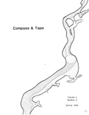
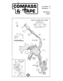
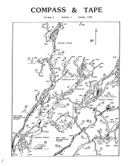
Volume 1,
Issue 1, Number 1 – Summer 1983 – pp. 1-14 Edited by John Ganter, Assoc. Eds. Robert Swicegood & Cady Soukup Miscellaneous: Balloons, tripods, etc. p. 3 How to use the Suunto – George Veni p. 4 The wet Suunto… – Roberta Swicegood p. 6 Thoughts on surveying pits – Bill Steele p. 8 AMCS map symbols – Peter Sprouse p. 9 Say, how high is that dome? – John Ganter p. 10 Membership list p. 12 Great (!?) moments in surveying p. 13 |
 |
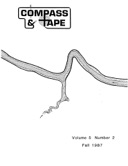
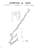
Volume 1,
Issue 2, Number 2 – Fall 1983 – pp. 15-31 Edited by John Ganter, Assoc. Eds. Robert Swicegood & Cady Soukup From the Editor p. 16 Pennsylvania Cave Survey – Keith Wheeland p. 17 Keson open-reel tape modification – Art Pettit p. 23 Cave survey notebooks – John Ganter p. 25 Things to buy – John Ganter p. 27 A protractor for the big board – John Ganter p. 28 Clogged pens – Roberta Swicegood p. 29 More on ferrous materials – John Ganter p. 30 Still more on ferrous materials – Roberta Swicegood p. 30 Ferrous wheel – Cady Soukup p. 30 The duksbak waterproof book – George Veni p. 31 |
 |
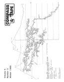
Volume 1,
Issue 3, Number 3 – Winter 1984 – pp. 32-49 Edited by John Ganter, Assoc. Eds. Robert Swicegood & Cady Soukup From the Editor p. 34 New Suunto p. 34 Cave locations and the USGS p. 35 Evolution of cave survey techniques in the West – Bill Storage p. 36 Geodetic control – John Ganter p. 38 Demented mental wanderings of a frustrated cave surveyor – George Dasher p. 41 Selected cave map symbols from the 1976 NSS Standard List p. 48 They took/ Time out/ For fun p. 49 |
 |
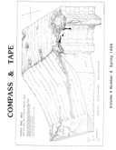
Volume 1,
Issue 4, Number 4 – Spring 1984 – pp. 50-65 Edited by John Ganter, Assoc. Eds. Robert Swicegood & Cady Soukup Thoughts on cave mapping – Dug Medville p. 52 Centerfolds 1 & 2 – Bernie Smeltzer, Duwain Whitis p. 54, 55 From the Editor – letter from Bill Storage p. 56 Storage on symbols – John Ganter p. 57 XEROX 2080 photocopier – Bill Torode p. 59 Bibliography of American cave mapping p. 61 Changes in SACS Convention Schedule p. 65 |
 |
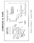
Volume 2,
Issue 1, Number 5 – Summer 1984 – pp. 1-21 Edited by John Ganter Kwik tape – Bill Torode p. 3 Suunto survey – John Carter p. 4 Paper Session 1984 – Paul A. Hill p. 7 Cave sketching – Keith Ortiz p. 9 The effect of tilt on compass error – Lang Brod p. 11 Sources of error in cave surveys – Dan Crowl p. 14 Centerfold: California Caverns – Cave City – Peter Bosted p. 17 Thoughts on sealing Suuntos – Lang Brod p. 19 Section Meeting 1984 – Paul Hill p. 21 |
 |
Volume 2,
Issue 2, Number 6 – Fall 1984 – pp. 22-43 Edited by John Ganter How to build an ultrasonic rangefinder – Bill Mixon p. 24 No ports, no problem – John Ganter p. 25 Do's and don't of cave surveying – Bill Douty p. 26 Caving paperwork – Jim Borden p. 28 Heavy questions – Warren Hoemann p. 30 Map reviews p. 31 Lettering – John Ganter p. 32 Cave survey with laser profiles – P. Waldhausl p. 38 Comments on Laprophot – John Ganter p. 40 Depth… revisited – John Ganter p. 42 1984 Cart Salon – Ernst Kastning p. 43 |
 |
Volume 2,
Issue 3, Number 7 – Winter 1985 – pp. 44-73 Edited by John Ganter Uncharted waters of sea cave surveying – Carol Vesely p. 46 Survey reduction with the HP-15C – Timoth H. Heaton p. 52 Mapping the tiny cave – George Veni p. 53 Rebuttal to Medville – Donald Davis p. 55 Bill Storage comments p. 57 Joe Saunders comments p. 58 Editorial: The Cart Salon – John Ganter p. 58 Map reviews p. 59 Cave lists: Science or pseudo-science – Raymond deSaussure p. 61 Coming attractions: Cart Salon and SACS Session '85 p. 62 Drawing profiles – John Ganter p. 63 Remote-template-controlled lettering – Toni L. Williams p. 66 The Ultrapod p. 70 Instrument rebuilds – John Ganter p. 70 More things to buy p. 72 Miscellany: Texas graphics and antique survey gear p. 73 |
 |
Volume 2,
Issue 4, Number 8 – Spring 1985 – pp. 74-86 Edited by John Ganter The Brunton compass: A solution to Suunto problems – Mike Futrell p. 76 Organization of a large mapping project: The Klamath Mountains – Mike Sims p. 78 Number of caves and cave maps for some US States p. 80 TI calculator software p. 81 New guide to mapping caves available p. 81 Centerfold: Cave of the Winding Stair – Bob Richards p. 82 The Editor thanks p. 83 SACS Session 1985: Frankfort, Kentucky p. 83 CAD/CAM survey plotting – Bruce F. Jelen p. 84 Mysterious terms explained – Tyler Groo p. 85 |
 |
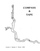
Volume 3,
Issue 1, Number 9 – Summer 1985 – pp. 1-26 Edited by John Ganter An outsider's look at the inside of a cave – Ellen Garsch p. 3 Financial report p. 11 SACS activities at NSS Convention 1985 – John Ganter p. 12 SACS Annual Meeting minutes – George Dasher p. 15 Balloons in action, Climax Cave, Georgia – Frank Huchinson p. 18 The Alabama Cave Survey – Greg McGill, Joe Domanovich p. 19 1985 NSS Cartographic Salon entries – John Ganter p. 20 Information, please: The Neitz Holtz Compass p. 21 Preserving spelean literature – Gary K. Soule p. 22 Preserving maps – John Ganter p. 23 Have you seen the book……??? – John Ganter p. 24 NSS Survey & Cartography Section Bylaws p. 25 Mapping humor – Carol Vesely, Gary O'Dell p. 26 |
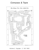 |
Volume 3,
Issue 2, Number 10 – Fall 1985 – pp. 27-54 Edited by John Ganter Survey team protocol: The hidden efficiency – Paul A. Hill p. 29 Random ramblings about this year's Cart Salon – Carol A. Vesely p. 33 Basic 35mm slide preparation – Bob Richards p. 36 When is a cave a CAVE ? – Phil Lucas p. 39 The Pennsylvania Cave Database & the microcomputer – Keith D. Wheeland p. 40 A computer program for finding quad names from coordinates – Keith D. Wheeland p. 42 Large cave rooms of the World: An interim report – John Ganter p. 43 Representing water in caves through the use of shading – John Ganter p. 44 More cave map symbols: Passage terminations – Mike Futrell p. 49 Cave mapping publications in the NSS Bookstore p. 49 Queries to the Editor p. 50 Official 1985 Cart Salon results p. 52 More on transfer films – E. Calvin Alexander p. 53 The Ultimeter altimeter/barometer – John Ganter p. 54 |
 |
Volume 3,
Issue 3, Number 11 – Winter 1986 – pp. 55-68 Edited by John Ganter From the Editor p. 57 The Mini-Compass – Bob Salika p. 58 A comment on passage termination symbols – Tyler Groo p. 59 Scaling and units of measurement in cave mapping – John Ganter p. 60 Pinpointing cave locations by satellite – Keith Wheeland p. 62 Donald Davis loses his compass p. 62 Cave locations and the U.S.G.S. p. 63 A response concerning the 1985 NSS Map Salon – Doug Medville p. 64 SACS members and subscribers p. 66 The Survey Team (Comics) – Rod Morris p. 68 Cavern areas of the U.S. (map from Davies & Morgan, 1980) p. 68 |
 |
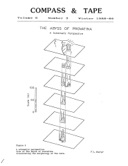
Volume 3,
Issue 4, Number 12 – Spring 1986 – pp. 69-90 Edited by John Ganter 3-D cave models – Peter Bosted p. 71 Towards a communicative cave report – John Ganter p. 73 Alternative measuring devices – Bill Torode p. 86 Surface sensing of caves: The Petro-Sonde device – John Ganter p. 87 Cartographic Salon summary, 1978 – 1985 – Ernst Kastning p. 89 In Cave of Fire, Remember Your Priorities (Cartoon) – Mike Futrell p. 89 Events: SACS Session and Meeting, 9th Annual Cartographic Salon p. 90 The Editor thanks p. 90 |
 |
Volume 4,
Issue 1, Number 13 – Summer 1986 – pp. 1-26 Edited by John Ganter, Assoc. Ed. Bob Hoke Topography in caverns: Work methodology – Claudio Jose, Mendes Pedrosa, Nivaldo Destro p. 3 Explorations aided by topography – Wolfgang Valle Walter p. 4 Backsights for fun and profit – Roberta Swicegood p. 6 The Cave Cartography Workshop: Some observations – Carol Vesely p. 8 Submitting material to Compass & Tape p. 11 One student's view: The Cartography & Survey Workshops – Lorna Greenway p. 12 Survey & Cartography Session: 1986 Convention – John Ganter p. 13 Map-Aid for cave maps – Richard Market p. 14 9th International Congress of Speleology – Bob Thrun p. 15 U.S.G.S. consolidates facilities p. 15 Cart Salon entries – Compiled by John Ganter p. 16 1986 Cartogrphic Salon results – Ernst Kastning p. 17 A short history of cave surveying – Bill Torode p. 18 How to draft a cave map without touching a pen – Tim Glover p. 19 3-D cartography for the rest of us – Gary R. Schaecher p. 20 A note on the Petro-Sonde p. 23 Minutes of the 1986 SACS Annual Meeting – George Dasher p. 24 |
 |
Volume 4,
Issue 2, Number 14 – Fall 1986 – pp. 27-40 Edited by John Ganter Editorial: How NOT to mark survey stations p. 29 Software developments p. 29 More on the Int. Congress of Speleology – Rich Breisch p. 30 A neoprene Suunto case – Carol Vesely p. 31 Cave mapping system – Steve Peerman p. 32 Book review: Atlas des Grandes Cavites Mondiales – Rich Breisch p. 35 Computer-aided sandscape maps (product) p. 36 Suunto protection – John Ganter p. 37 Cave mapping with the Bighorn Project (excerpt) – John Stembel p. 38 Sectional Charts & World Aeronautical Charts – Frank Reid p. 39 1987 SACS Session announcement – Dan Crowl p. 40 The Map Catalog (product) p. 40 |
 |
Volume 4,
Issue 3 & 4, Number 15 – Spring 1987 – pp. 41-56 Edited by John Ganter Averaging network elements – David McKenzie p. 43 Lighting up your Suunto – Richard Market p. 54 Army map-folding method preserves topos – Frank Reid p. 55 SPELEO-PRESS offers new services p. 56 UIS Commission on karst mapping p. 56 Mexico maps available from Peter Sprouse p. 56 New Editor sought p. 56 |
 |
Volume 5,
Issue 1, Number 16 – Summer 1987 – pp. 1-20 Edited by John Ganter The transit-survey myth – Bill Mixon p. 3 Hold the light a little closer – Russ Gurnee p. 5 NSS Committee on Long & Deep Caves p. 8 1987 SACS Session Papers (abstracts) p. 10 Geomagnetics news p. 11 A SMAPS/Autocad interface – Jim Nepstad p. 12 1987 SACS Annual Meeting – Dave West p. 13 LORAN-C for cavers (updated) – Frank Reid p. 14 Suunto instrument maintenance – Ian McKenzie p. 17 More on Suunto instrument maintenance – Doug Medville p. 18 TSA Instrument Cave p. 18 1987 NSS Cartographic Salon entries p. 19 GeoScience resources p. 20 |
 |
Volume 5,
Issue 2, Number 17 – Fall 1987 – pp. 21-48 Edited by John Ganter On cave survey blunders – Fred L. Wefer p. 23 Testing the Ultimeter – John Ganter p. 44 |
 |
Volume 5,
Issue 3, Number 18 – Winter 1988 – pp. 49-62 Edited by John Ganter Survey German-style in the Austrian Alps – Carol Vesely p. 51 Mental calculation of reciprocal bearings – Frank Reid p. 54 Thread-measuring devices: A review – John Ganter p. 55 A trigonometric analysis of Suunto sighting error – Brad Neff p. 60 |
 |
Volume 5,
Issue 4, Number 19 – Spring 1988 – pp. 63-114 Edited by John Ganter Editorial: Will we map as we survey? – John Ganter p. 65 Some comments from across the pond – Bryan Eillis p. 67 The Autohelm personal compass – Frank Reid p. 78 More on cave survey blunders – Fred L. Wefer p. 79 Still more on cave survey blunders – Fred L. Wefer p. 94 |
 |
Volume 6,
Issue 1, Number 20 – Summer 1988 – pp. 1-20 Edited by Tom Kaye One judge's view – George Dasher p. 3 Sketching – George Dasher p. 5 On the origin of the Topofil surveying device – Claude Chabert p. 8 Survey grading – George Dasher p. 10 Minutes of the 1988 Surveying and Cartography Section – Tom Kaye p. 17 New Editor p. 18 |
 |
Volume 6,
Issue 2, Number 21 – Fall 1988 – pp. 1-32 Edited by Tom Kaye CAD applications at Wind Cave – Jim Nepstad p. 3 50 years of cave mapping: A brief overview – John Ganter p. 9 Using one eye with the Suunto – Roger V. Bartholomew p. 16 An evaluation of the Autohelm personal compass for cave surveying – Roger V. Bartholomew p. 21 Total vertical traverse – Bill Mixon p. 24 Don't use two eyes with your Suunto – Robert Thrun p. 25 Flashlight Tip – Barbara am Ende p. 25 Letter to the Editor – Lang Brod p. 26 Letter to the Editor – Sue Bozeman p. 27 Letter to the Editor – John P. Brooks p. 28 Reply to Ms. Bozeman – George Dasher p. 28 Reply to Mr. Brooks – George Dasher p. 30 Letter to the Editor – George Dasher p. 30 Editor's remarks – Tom Kaye p. 31 |
 |
Volume 6,
Issue 3, Number 22 – Winter 1988-89 – pp. 1-19 Edited by Tom Kaye The plumbing of Provatina – Fred L. Wefer p. 3 The need for standardized cave map salon judging criteria – Rich Breisch p. 12 Some tidbits on solo surveying – Kevin and Carlene Allred p. 14 Comments on standardized map judging – John Ganter p. 16 |
 |
Volume 6,
Issue 4, Number 23 – Spring 1989 – pp. 1-30 Edited by Tom Kaye CAD for cave mapping: A cautious assessment – John Ganter p. 3 Regional surveys and where to find more caves – George Veni p. 18 Karst features maps – David A Hubbard, Jr. p. 21 Reply to standardization appeal – Robert Thrun p. 23 Map salon judging – further comments – George Dasher p. 23 More on the map salon judging – Becky Jagnow p. 24 More varieties of blunders – Robert Thrun p. 26 Preliminary impressions of SMAPS 4.2 – John Ganter p. 28 Editor's comments – Tom Kaye p. 29 |
 |
Volume 7,
Issue 1, Number 24 – Summer 1989 – pp. 1-26 Edited by Tom Kaye The computerization of the cave map – Fred L. Wefer p. 3 The 1989 NSS Cartographic Salon – George Veni p. 15 Cave mapping and sensitive information – John Ganter p. 20 Wind Cave map in 3D – Rich Breisch p. 21 Letter to the Editor – George Dasher p. 22 The minutes of the 1989 Surveying and Cartography Section meeting – George Dasher p. 23 |
 |
Volume 7,
Issue 2, Number 25 – Fall 1989 – pp. 1-22 Edited by Tom Kaye A North arrow and scale for stage-4 cave maps – Fred L. Wefer p. 3 Suunto modifications for a light rod – Lang Brod p. 13 Book review of An Introduction to Cave Surveying by Bryan Ellis – Bob Hoke p. 21 |
 |
Volume 7,
Issue 3, Number 26 – Winter 1989-90 – pp. Edited by Tom Kaye Viewing definition and control for stage-4 cave maps – Fred L. Wefer p. 3 Cartographic Salon [announcement] – George Dasher p. 20 The California Convention – Carol Vesely p. 20 The NSS Cartography Salon Organization and Judging Criteria – The SACS Cartographic Salon Committee p. 23 Book review – Rich Breisch p. 28 Survey instrument maintenance update – Ian McKenzie p. 30 |
 |
Volume 7,
Issue 4, Number 27 – Spring 1990 – pp. 1-34 Edited by Tom Kaye Content definition and control for stage-4 cave maps – Fred L. Wefer p. 3 Cave visualization using voxels – an alternative to commercialization – Richard L Breisch p. 24 Discussion of Wefer's "The computerization of the cave map" and "A North arrow and scale for stage-4 cave maps" – John Ganter p. 29 Rivalry error in two-eyed Suunto sightings – Roger V. Bartholomew p. 30 Past medal winners of the NSS' Cartographic Salon – compiled by George Dasher p. 33 Survey tips and techniques – Tom Kaye p. 33 |
 |
Volume 8,
Issue 1, Number 28 – Summer 1990 – pp. 1-36 Edited by Tom Kaye Miscellaneous operations for stage-4 cave maps – Fred L. Wefer p. 3 Cave map language: Yet another cave compiler – Mel Park p. 22 Tips and Techniques: Blue light in caves – Frank McNutt p. 31 Tips and Techniques: Refurbishing Suuntos – George Veni p. 31 Tips and Techniques: How to clean your Suuntos – Beth Webb p. 31 Maps of the 1990 Cartographic Salon – reported by George Dasher p. 32 Minutes of the 1990 meeting of The Surveying and Cartography Section of The National Speleological Society – George Dasher p. 35 |
 |
Volume 8,
Issue 2, Number 29 – Fall 1990 – pp. 1-14 Edited by Tom Kaye A paradigm for digitized cave mapping – John Fogarty p. 3 Macintosh graphics from SMAPS – Tim Kilby p. 12 New laser printer materials may interest cave mappers – Tim Kilby p. 13 |
 |
Volume 8,
Issue 3, Number 30 – Winter 1990-91 – pp. 1-24 Edited by Tom Kaye The accuracy of a cave survey – Denis Warburton p. 3 Commentary on Warburton article – Bob Thrun p. 20 An evaluation of the SmartLevel as a survey inclinometer – Roger V. Bartholomew p. 21 |
 |
Volume 8,
Issue 4, Number 31 – Spring 1991 – pp. 1-26 Edited by Tom Kaye Clipboard surveying – Tom Kaye p. 3 Tilt error in Suunto compasses sighted with the glass rod cylindrical lens – Roger V. Bartholomew p. 6 The topo digitizing program or using a digitizing tablet to get cave coordinates – Robert Thrun p. 12 Index for the Compass and Tape – George Dasher p. 13 Cumulative index for the Computer Applications Section Newsletter – Bob Hoke p. 23 |
 |
Volume 9,
Issue 1 & 2, Number 32 – Summer & Fall 1991 – pp. 1-26 Edited by Tom Kaye What's it worth? – Tom Spina p. 3 Theoretical vs. experimental compass tilt error – Robert Thrun p. 5 GPS—The 90's way to locate caves – Tim Kilby p. 6 The realities of cave mapping – C. A. Vesely p. 7 The only cave map on a postage stamp – Rich Breisch p. 8 Derivation of cave closure weighting factors – Tom Kaye p. 9 Observations of an NSS map salon judge – Ed Devine p. 12 The use of "T.H.C." on cave maps – Robert Thrun p. 16 Book review: The Precision Survey of Lechuguilla Cave – Rich Breisch p. 18 Book review: Mapping Jewel Cave – from the Surface – Rich Breisch p. 19 1991 Cartographic Salon report – George Dasher p. 20 The minutes of the 1991 annual Surveying and Cartography Section Meeting p. 21 Editor's comments – Tom Kaye p. 22 National Speleological Society Survey and Cartography Section p. 22 Survey and Cartography Section Membership List p. 23 |
 |
Volume 9,
Issue 3 & 4, Number 33 – Winter & Spring 1992 – pp. 1-20 Edited by Tom Kaye The north arrow — an important directional standard – Ed Devine p. 3 National Geomagnetic Information Center: GEOMAG – U.S. Geological Survey p. 7 Baseline measurement by solar observation – Ed Devine p. 8 Theory & experiment in tilt error in Suunto compasses sighted with the glass rod cylindrical lens – Roger V. Bartholomew p. 17 Future cave survey technology – Roger V. Bartholomew p. 18 Letter to the Editor – George Dasher p. 19 Corrections – Tom Kaye p. 20 |
 |
Volume 10,
Issue 1 & 2, Number 34 – Summer & Fall 1992 – pp. 1-20 Edited by Tom Kaye The Minutes of the 1992 Surveying and Cartography Section – George Dasher p. 3 Lost: Critique Sheet – George Dasher p. 5 Call for convention papers and maps – Bob Hoke p. 6 Letter to the C&T Editor – Bob Hoke p. 6 The perfect cave trip – Hubert Crowell p. 6 Letter to the Editor – Philip Moss p. 8 Cave locations on maps – Tom Kaye p. 9 1992 NSS Cartographic Salon – George Dasher p. 10 NSS Cartographic Salon Medal Winners – George Dasher p. 12 NSS Cartographic Salon Chairman ramblings – George Dasher p. 13 Cartographic Salon medal award name – George Dasher p. 15 Keep the Cartographic medal depersonalized – Bob Hoke p. 19 Bernie Smeltzer 'pro' article – Tom Kaye, ed. p. 19 You could be the Editor – Tom Kaye p. 19 |
 |
Volume 10,
Issue 3 & 4, Number 35 – Winter & Spring 1993 – pp. 1-20 Edited by Tom Kaye LRCF.'s (Lotsa Ridiculous Cave Features) – Dave Collings p. 3 Survey cheat sheet – Howard Kalnitz p. 9 Suunto instruments – Mark Minton p. 11 Basic cave surveying in Alaska – Carlene Allred p. 12 Calibration of the KVH DataScopeTM – Hubert C. Crowell p. 17 |
 |
Volume 11,
Issue 1 & 2, Number 36 – Summer & Fall 1993 – pp. 1-18 Edited by Tom Kaye Some lessons in running a successful cave survey project – Bob Hoke p. 3 Surveying efficiently: Tricks of the trade – Carol Vesely p. 7 Comment on LRCFs: Measure them! – George Veni p. 9 Survey Contest 1993 Convention – Hubert C. Crowell p. 10 1993 NSS Cartographic Salon – George Dasher p. 12 1994 National Speleological Society Convention Call For Papers: Equipment & Techniques Session p. 13 NSS Survey and Cartography Section papers – Roger Bartholomew p. 14 New Editor – Tom Kaye p. 14 SACS memberships extended – Bob Hoke p. 14 Available: NSS News and NSS Bulletin back issues – John Ganter p. 15 Minutes of the 1993 Annual Meeting of the Survey and Cartography Section of the NSS – Bob Hoke p. 15 |
 |
Volume 12,
Issue 1, Number 37 – January 1995 – pp. 1-26 Edited by Pat Kambesis The minutes of the 1994 Surveying and Cartography Section meeting – George Dasher p. 2 Announcements: On Station p. 5 Announcements: Buckeye Bulletin p. 5 Announcements: Convention 1995: Call for papers p. 5 1994 NSS Cartographic Salon – George Dasher p. 6 NSS Cartographic Salon criteria p. 8 Protecting Suunto instruments – Mike Yocum p. 9 The OTR compass course: Or: The need for compass' courses – George Dasher p. 12 Cartoon from The RASS Register p. 13 Survey standards: Cave survey standards for Carlsbad Caverns National Park – Cave Resource Office at Carlsbad Caverns National Park p. 14 Cave mapping – Jim Nieland p. 21 Survey & Cartography Section membership list – January, 1995 p. 23 |
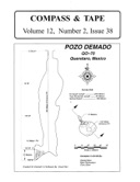 |
Volume 12,
Issue 2, Number 38 – July 1995 – pp. 1-29 Edited by Pat Kambesis Message from the Chairman – Carol Vesely p. 2 LRCFs: We can do better – Peter Sprouse p. 3 The art of lead tape and other related ramblings – Tom Moss p. 4 Observations on survey sketch quality – Mike Yocum p. 9 Creating electronic maps from true to scale cave survey sketches – Garry Petrie p. 16 On guidelines for electronic maps – Pat Kambesis p. 19 Survey standards for Hidden River Cave Project – Mike Yocum p. 26 Graphical solution for determining ceiling heights – Pat Kambesis p. 29 |
 |
Volume 12,
Issue 3, Number 39 – January 1996 – pp. 1-25 Edited by Pat Kambesis FFrom the Editor: – Pat Kambesis p. 1 Letters to the Editor p. 2 1995 Survey and Cartography Section meeting – George Dasher p. 11 Call for papers – 1996 NSS Convention p. 12 1995 NSS Cartographic Salon – George Dasher p. 13 Cave cartography using Autocad – Bert Ashbrook p. 14 Documenting cave entrance descriptions and locations – George Dasher p. 20 Report on the "Criteria for Judging Electronic Maps" session of the 1995 Convention – or clueless in Blacksburg – Pat Kambesis p. 21 Comments and suggested guidelines for electronic maps – Fred Wefer p. 22 |
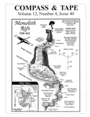 |
Volume 12,
Issue 4, Number 40 – July 1996 – pp. 1-25 Edited by Pat Kambesis From the Editor: – Pat Kambesis p. 1 Chairman's message – Carol Vesely p. 2 Letters to the Editor p. 3 Blunder location – Larry Fish p. 5 Accuracy of GPS receivers and an attempt at do-it-yourself differential GPS – Robert Thrun p. 12 Why have lava tube survey standards? – Kevin Allred p. 19 Kazumura Cave Project of the HSS – Survey standards – Kevin Allred p. 19 Cartographers Corner – Pat Kambesis p. 24 |
 |
Volume 13,
Issue 1, Number 41 – April 1997 – pp. 1-25 Edited by Pat Kambesis From the Editor – Pat Kambesis p. 1 Letters to the Editor p. 2 1996 Cartography Salon – George Dasher p. 3 Survey and Cartography Section meeting - August 20, 1996 – George Dasher p. 4 Judges wanted for the 1997 Cartography Salon – George Dasher p. 5 NSS Cartography Salon organization and judging criteria – George Dasher p. 6 From the Cartography Salon Chairman some thoughts on the 1996 Cartography Salon – George Dasher p. 11 The problem with least squares loop closures – Larry Fish p. 15 Computer graphics for cave maps – David Parr p. 19 No excuse for not knowing magnetic declination – Bert Ashbrook p. 23 Cartographers Corner – Pat Kambesis p. 24 |
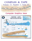 |
Volume 13,
Issue 2, Number 42 – April 1998 – pp. 1-25 Edited by Pat Kambesis From the Editor – Pat Kambesis p. 1 Call for papers for 1998 NSS Convention p. 2 Survey and Cartography Section meeting – June 26, 1997 – George Dasher p. 3 1997 Cartographic Salon awards – George Dasher p. 5 Computer graphics – A FreeHand way to generate and display cave maps – Bob Richards p. 7 On surveying underwater caves – Jim Coke p. 13 Notes for cave surveyors on the Earth's magnetic field, and orienting cave surveys to True North using the USGS GEOMAG program – Ira D. Sasowsky p. 20 Mapping equipment for wet caves – Philip L. Moss p. 23 Cartographers' Corner – Cross sections and elevation data – Pat Kambesis p. 24 |
 |
Volume 13,
Issue 3, Number 43 – July 1998 – pp. 1-25 Edited by Pat Kambesis Section business/Letters to the Editor p. 2 Magnetic influences upon compass accuracy – Doug Strait p. 3 Errors in the Suunto compass used for cave surveying – Lang Brod p. 5 Hourly variation of magnetic declination – Robert Thrun p. 14 Surveying and the role of geological data – Dr. A. R. Farrant p. 15 Two AutoCAD linetypes for cave cartography – Bert Ashbrook p. 18 Ceiling height determination in large rooms with common cave surveying equipment – Jim Glock p. 19 Report on UID Symbols List for Cave Survey – submitted by Garry Petrie p. 20 |
 |
Volume 13,
Issue 4, Number 44 – March 1999 – pp. 1-21 Edited by Pat Kambesis Call for papers, 1999 Convention, Filer, Idaho p. 2 Survey and Cartography Section minutes – George Dasher p. 3 1998 Cartographic Salon p. 5 Data reduction/plotting program questionnaire – George Dasher p. 6 A comparison of simultaneous and sequential closure adjustment methods – Robert Thrun p. 9 Additional comments on adjustment methods – Robert Thrun p. 14 Rebuttal: Simultaneous vs. sequential loop closures – Larry Fish p. 15 In the Spotlight – SACS Junior Cartographers: Indian Ladder Cave – George Dasher p. 20 In the Spotlight – SACS Junior Cartographers: Rising stars in a caving family – Pat Kambesis p. 21 |
 |
Volume 14,
Issue 1, Number 45 – June 1999 – pp. 1-21 Edited by Pat Kambesis Suunto compass holding methods – Eric Hendrickson p. 2 More thoughts regarding simultaneous and sequential loop closures – Bert Ashbrook p. 4 Sidebar: Illustrating a problem with the sequential method – Bert Ashbrook p. 4 Simultaneous/sequential closure: Round 2 – Robert Thrun p. 6 More discussion of least squares loop closures – Larry Fish p. 8 Overview on least squares cave survey issues – John Halleck p. 11 Cave survey software: What features do you need and/or want? – Pat Kambesis p. 14 Templates for reading topo map coordinates – Robert Thrun p. 14 Survey and Cartography Session abstracts 1998 NSS Convention, Sewanee, Tennessee p. 19 |
 |
Volume 14,
Issue 2, Number 46 – February 2000 – pp. 1-25 Edited by Pat Kambesis Call for papers – Survey & Cartography Section, NSS Convention 2000, Elkins, West Virginia p. 2 1999 Survey & Cartography Section Meeting Minutes – Filer, Idaho – submitted by Bob Hoke p. 3 Cartographic Salon 2000 announcement p. 4 Judging criteria for NSS Cartographic Salon – by SACS Cartographic Salon Committee p. 5 1999 NSS Cartographic Salon entries and winners – Hazel Barton p. 12 How common are blunders in cave survey data? – Larry Fish p. 14 Intermediate cave survey tips & techniques – Bob Hoke p. 18 Internal angles examples – John Halleck p. 21 Mapping the tiny cave – George Veni p. 24 |
 |
Volume 14,
Issue 3, Number 47 – October 2000 – pp. 1-17 Edited by Pat Kambesis Letters to the Editor p. 2 2000 Survey & Cartography Section meeting minutes, Elkins, WV – submitted by George Dasher p. 7 Survey and Cartography Session abstracts NSS Convention 2000 p. 11 NSS Cartographic Salon 2000 entries and winners – Rod Horrocks p. 14 Notes on Adobe Acrobat for cave maps – John Ganter p. 16 |
 |
Volume 14,
Issue 4, Number 48 – October 2000 – pp. 1-35 Edited by Pat Kambesis; Guest Editor Scott Schmitz From the Editor – Pat Kambesis and Scott Schmitz p. 2 Judges comments from the 1999 NSS Cartography Salon – Steve Reams p. 2 Judges' scoring sheet p. 4 Cartographic Salon entries and winners – 1999 NSS Convention – Hazel Barton p. 5 Bry Ice Cave – Bill Broeckel p. 6 James Cave – Jim West and Kenneth Storey p. 9 Hellsinky – Connie LaPerriere p. 12 Las Grutas De Cuesta Chica – Abigail Wines p. 13 Goa Hatu Saka – Chris Andrews p. 16 Eiswert Cave #2 – Jim Kennedy p. 18 New Cave – Garry Petrie p. 20 Lime Creek Cave – Paul Burger p. 22 Narrows Cave – Paul Burger p. 25 Sexton Section of Kazumura Cave – Bob Richards p. 29 Cueva de Villa Luz – Bob Richards p. 31 Arabica Cave – Carlene Allred and David Love p. 34 Critique of the 1999 cartographic critique p. 35 |
 |
Volume 15,
Issue 1, Number 49 – May 2001 – pp. 1-26 Edited by Pat Kambesis Letters to the Editor p. 2 The 2001 Cartographic Salon – Steve Reams p. 4 Call for papers p. 5 Linear symbols for cave maps in Freehand – John Ganter p. 6 <?Cave survey data in XML?> – Devin Koots p. 10 Computer modelling of cave passages – Larry Fish p. 19 Compass brands and their manufacturers – Bob Thrun p. 25 |
 |
Volume 15,
Issue 2, Number 50 – December 2001 – pp. 1-18 Edited by Pat Kambesis NSS Survey and Cartography Section meeting minutes. July 27, 2001 – Suzanne Deblois p. 2 2001 Cartographic Salon report – Steve Reames p. 4 Pan and ink: A new salon category? – Steve Reames p. 6 Experiments in creating high fidelity cave models: Part 1 – Getting the data – Greg Passmore p. 7 The International Foot versus the U.S. Survey Foot or the case of the galloping caves – Larry Fish p. 11 Tunnel reconstruction from sparse range data using interpolated implicit surfaces – Thomas Lesperance p. 15 |
 |
Volume 15,
Issue 3, Number 51 – May 2002 – pp. 1-20 Edited by Pat Kambesis Ultrasonic cave mapping – W.I. Sellers and A.T. Chamberlain p. 4 Canvas map makers guide – Paul Burger p. 12 The transit survey myth – Bill Mixon p. 18 |
 |
Volume 15,
Issue 4, Number 52 – December 2002 – pp. 1-17 Edited by Pat Kambesis Call for papers p. 4 Minutes of the 2002 Survey and Cartography Section meeting p. 5 2002 Cartographic Salon results – Steve Reames p. 8 Development and testing of three components of the process of transferring digital cave survey data – Mike Yocum p. 9 Obituary: Mike Yocum p. 17 |
 |
Volume 16,
Issue 1, Number 53 – August 2003 – pp. 1-15 Edited by Pat Kambesis From the Editor p. 3 Survey and Cartography Section meeting minutes NSS Convention, Porterville, California p. 4 Instructional workshops and sessions at the 2003 NSS Convention – Pat Kambesis p. 5 2003 Cartographic Salon results – Salon Coordinator: Rod Horrocks p. 7 Survey and Cartography Session, Porterville, California – Session Coordinator: Roger Bartholomew p. 10 GIS Digital Mapping Symposium – Session Coordinator: Bernie Szukalski p. 13 |
 |
Volume 16,
Issue 2, Number 54 – November 2003 – pp. 1-20 Edited by Pat Kambesis From the Editor p. 3 Errata p. 4 Call for maps and papers NSS Convention 2004 p. 5 Summary of Cartographic Salon awards 1978-2003 – compiled by George Dasher p. 6 Digital cave drawing with Mayura Draw – Erik Halbert p. 8 Precision surveys with the Brunton compass – Art Palmer p. 16 Magnetic storms – Bob Thrun p. 19 |
 |
Volume 16,
Issue 3, Number 55 – March 2004 – pp. 1-19 Edited by Pat Kambesis Call for papers p. 4 Cartographic Salon 2004 announcement p. 5 Cave maps by Xara X – Tom Lounsbury p. 6 Digital airbrushing of cave maps – Bob Richards p. 16 Catastrophic compass failure – Wookey p. 19 |
 |
Volume 16,
Issue 4, Number 56 – December 2004 – pp. 1-19 Edited by Pat Kambesis Minutes from 2004 Survey & Cartography Section meeting, Marquette, Michigan – George Dasher p. 4 Cartographic Salon 2004 results – George Dasher p. 5 Abstracts from 2004 Survey and Cartography – Session Chair – Bob Hoke p. 7 The effects of lava on compass readings: Part I – Dale Green p. 9 |
 |
Volume 17,
Issue 1, Number 57 – February 2005 – pp. 1-25 Edited by Pat Kambesis Call for papers, 2005 NSS Convention p. 4 The effects of lava on compass readings: Part II – Dale J. Green p. 5 Auriga, or trading your survey notebook for a PDA – Luc Le Blanc p. 12 An analysis of systematic and survey errors or better surveying through mathematics – Dave Andreatta p. 16 |
 |
Volume 17,
Issue 2, Number 58 – November 2005 – pp. 1-17 Edited by Pat Kambesis Raders Valley Project – Mark Passerby p. 4 Protecting your Suuntos – Mark Ohms p. 9 Finding loops in cave surveys – Larry Fish p. 10 |
 |
Volume 17,
Issue 3, Number 59 – October 2006 – pp. 1-17 Edited by Pat Kambesis Minutes from 2005 Survey & Cartography Section meeting p. 4 Minutes from 2006 Survey & Cartography Section meeting p. 5 2005 NSS Cartographic Salon results – Jim "Crash" Kennedy p. 7 2006 (29th Annual) NSS Cartographic Salon, Bellingham, Washington – Jim "Crash" Kennedy p. 8 Hydroleveling of very deep caves, with an example from Voronja (Krubera) Cave – Alexander Degtjarev, Eugene Snetkov, and Alexey Gurjanov p. 10 |
 |
Volume 17,
Issue 4, Number 60 – December 2007 – pp. 1-17 Edited by Pat Kambesis Minutes from 2007 Survey & Cartography Section meeting p. 4 2007 Cartographic Salon results p. 6 Cave surveys, cave size, and flank margin caves – John Mylroie p. 8 Common blunders during the survey trip – Bob Hoke & Pat Kambesis p. 17 |
 |
Volume 18,
Issue 4, Number 61 – July 2010 – pp. 1-17 Edited by Pat Kambesis Minutes from 2009 Survey & Cartography Section meeting p. 4 ICN/NSS 2009 Cartographic Salon Results p. 5 Survey Techniques for Xe Bang Fai River Cave, Loas People's Democratic Republic – Aaron Addison p. 7 How I Learned to Love Cross Sections – Testimonial from a survivor of GCSS – Jeff Bartlett p. 11 The Effect of Binocular Vision Disorders on Cave Surveying Accuracy – Mark Dougherty p. 17 |